

Sarrail Ridge is one of the most beautiful hikes in Kananaskis Country.
It is not the easiest hike especially if you do it early in the season but the views from the top are breathtaking.
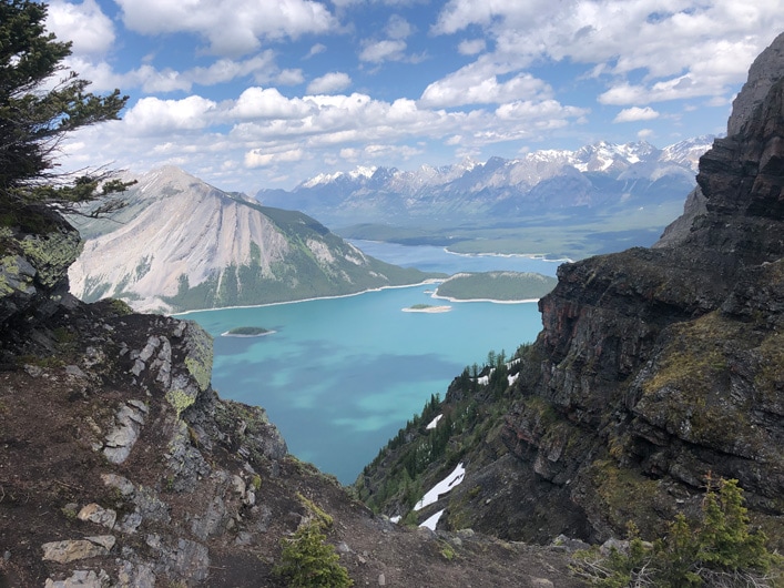
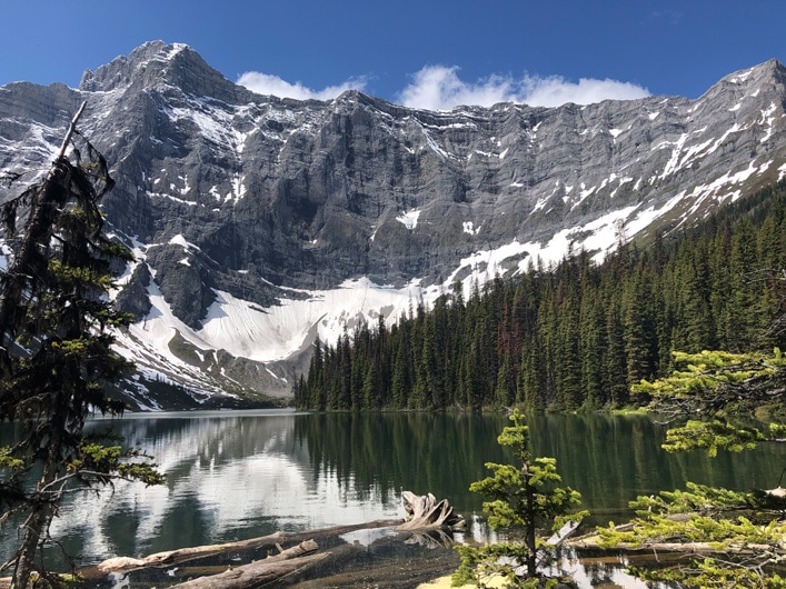
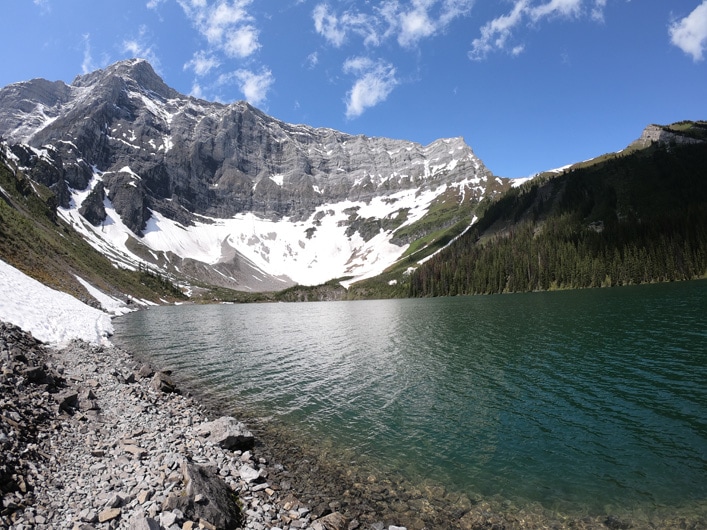
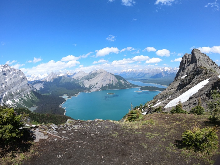
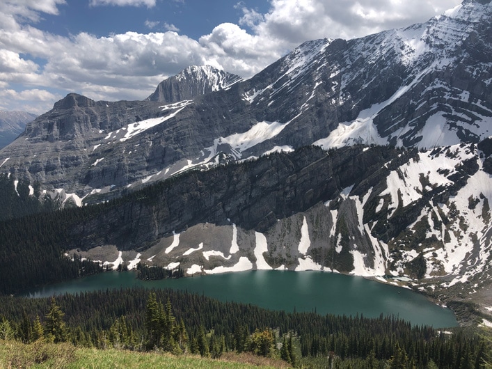
From the ridge, you can see a beautiful Upper Kananaskis Lake surrounded by mountains on one side and picturesque Rawson Lake on the other.
What is the best time to hike Sarrail Ridge?
The best time to hike Sarrail Ridge is between the middle of June and the end of August.
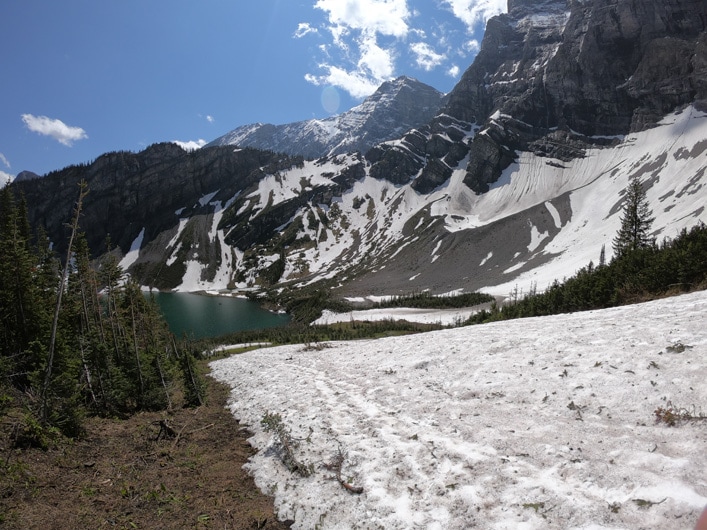
I hiked both in June and July and each time there was quite a bit of snow both around the Rawson Lake and closer to the ridge of Mout Sarrail.
It was hardened snow from avalanches that takes a while to melt.
When I hiked it recently at the beginning of July, the trail to Rawson Lake was quite busy but the number of hikers attempting to hike Mount Sarrail was much lower.
One of the challenges is the snow that you need to pass around Rawson Lake to get to Mount Sarrail.
If you are not careful, you might end up in the cold lake.
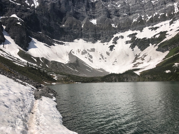
There is also a chance of avalanches if you go too early in the season.
I could hear small avalanches even in July.
The trail to Rawson Lake is much easier and can be hiked anytime between May and September.
If possible, try to hike as early in the morning as possible to avoid the crowds.
How long is Sarrail Ridge hike?
It took me around 4.5 hours to finish this hike with a picnic at the top.
Based on my Apple Watch tracker the distance was 12.5 km total from the parking lot and elevation gain was around 750 m.
I read somewhere that official elevation gain is closer to 1000 m but both times I did this hike it was around 750 m.
How to get to Sarrail Ridge and Rawson Lake trailhead?
If you are driving from Calgary, take TransCanada West towards Banff and then turn onto Highway 40 (Kananaskis Trail) at Stoney Nakoda Casino.
Drive south on Highway 40 towards the turn to Kananaskis Lakes.
It will be on the right side just before the winter gate.
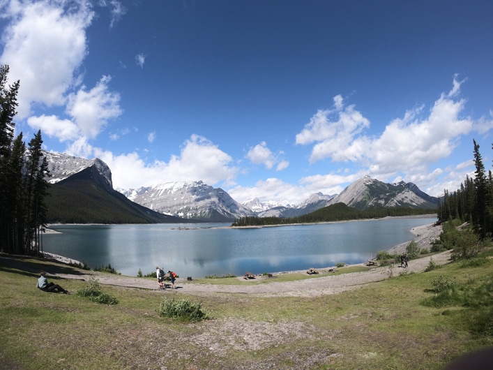
From there follow the signs to Upper Kananaskis Lake and drive to the furthest parking lot (keep going left) located by day-use area.
You should see a washroom from there.
At the back of the washroom, you will find a trailhead.
Before driving, it might be worth checking the Alberta Parks website to see if Rawson Lake trail it is open.
Sometimes it gets closed due to bear activity.
Hiking to Sarrail Ridge and Rawson Lake
There are two steps to hiking Sarrail Ridge.
The first step is to hike to Rawson Lake.
The trail to Sarrail Ridge starts behind the Rawson Lake.
Hiking to Rawson Lake
This is a relatively easy hike and everyone can do it.
However, it can get quite muddy early in the season or if it was raining for a few days.
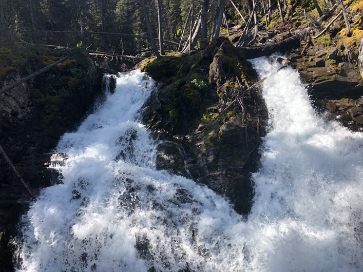
From the parking lot follow the trail that starts behind the washroom for a short distance and after the waterfalls take left on the junction.
You will see a sign there.
If you don’t take left, you will end up going around the Upper Kananaskis Lake.
After the junction just follow the trail to Rawson Lake.
Some parts of this trail might be a little steep but in general, it is an easy hike all the way to Rawson Lake.
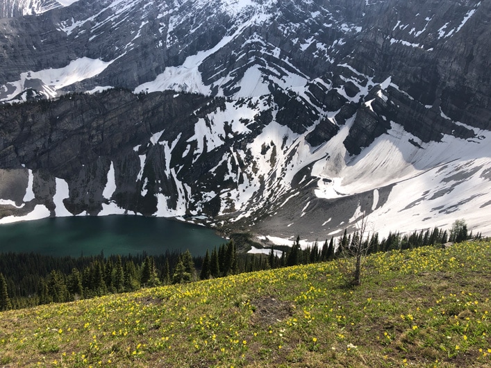
When you get to the lake, take time to relax and enjoy gorgeous views of the nearby mountains reflecting in the lake.
Hiking to Sarrail Ridge
This is where the hard part begins.
The trail from Rawson Lake to Sarrail Ridge is not long but the elevation gain is quite impressive.
That’s where you will start to appreciate the benefit of having hiking poles and good shoes.
I hiked without the poles but it wasn’t easy.
Follow the trail around Rawson Lake to the bottom of Mount Sarrail.
From there it is just up to the ridge.
After a grinding hike up to Mount Sarrail which may take up to 1.5 hours from Rawson Lake, you will get to the ridge at the top.
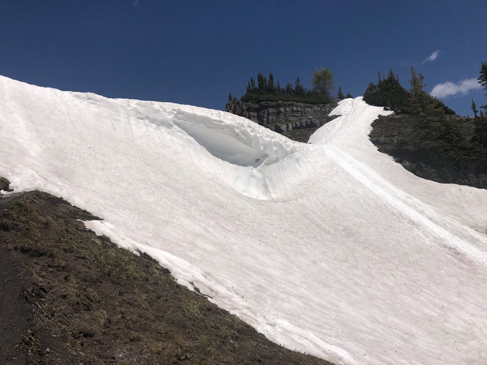
If you go in early June, there will be some snow just before the ridge that you need to pass. Exercise caution there.
The views from the ridge are unbelievable.
There are several spots at the top to take Instagram worthy photos and have lunch.
Be careful when going down from the ridge because the slope is steep and depending on the trail conditions it might be easy to slip.
I saw a few hikers sliding down on snow on the way back but I would imagine it is not the safest way to finish the hike.
Conclusion
Mount Sarrail is an amazing hike that everyone in the area should do.
If you realize that you are not ready for it or the weather is not cooperating, you can always stop at Rawson lake and hang out there.
Alternatively, there is a 17 km hike around the Upper Kananaskis Lake that is mostly flat that you can always do as well.
Did you know that your internet service provider can track your online activity? Want to hide your identity online and keep your browsing habits private? Try NordVPN!
*This post might contain affiliate links. If you click on a link, I might receive a small commission.