

I only recently discovered Carnarvon Lake and immediately wanted to hike there.
Conveniently located just over one hour away from Calgary this lake is positioned on a border of Alberta and BC.
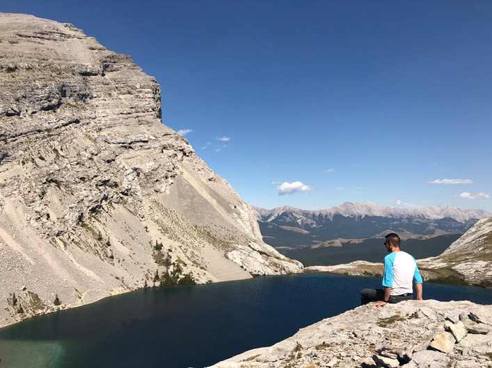
Carnarvon Lake is arguably one of the most pristine lakes in Kananaskis Country.
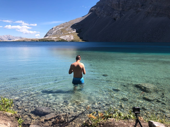
If not for 15 C water, you might think that you are swimming in a tropical ocean when taking a dip in this beautiful lake.
There are several spots around the lake that you can use for random camping if you decide to stay for a night.
There are also fish in Carnarvon Lake if you are into fishing.
How to get to Carnarvon Lake?
The trailhead to Carnarvon Lake starts at Cat Creek day-use area located along highway 40 in Kananaskis.
To get there take highway 22 south (Cowboy Trail) and before reaching Longview exit onto highway 541.
Later highway 541 connects with highway 40 that goes through Kananaskis Country.
Keep in mind that this section of highway 40 is closed in the winter from December to the middle of June.
From there drive for around 49 km until you see Cat Creek day-use area on your left.
Park at the very north end of the Cat Creek.
The trailhead to Carnarvon Lake starts from there and the trail follows Highwood River.
Get a map of Carnarvon Lake hike before going there.
There is no service on this trail as on almost any other hike in Kananaskis.
The trail is wide and easy to follow but having a map or using GPS is recommended.
How hard is Carnarvon Lake hike?
Carnarvon Lake hike is around 23 km in length with an elevation gain of close to 900 m.
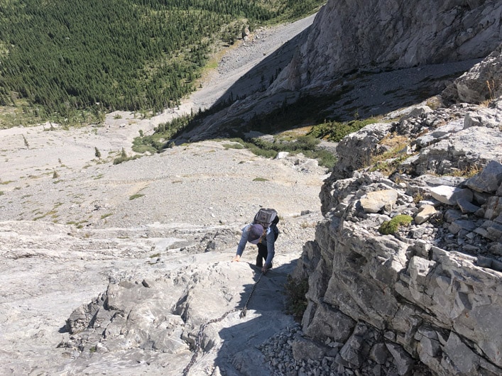
The trail to the lake is pretty flat until you reach the final section where you have to use chains to get to the lake.
I didn’t find the chain section too challenging but if you are carrying a large backpack with all your camping gear, you might find it hard.
If you are doing this hike in one day as I did, plan for a 9 hour day.
Hiking to Carnarvon Lake
After you park at the Cat Creek area, the trail will be flat for the first 5 kilometers.
If you have a mountain bike, you might save time by biking this section and then hiking the rest.
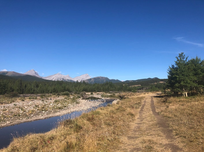
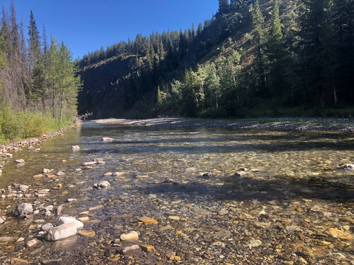
At around 2.2 km from the start of the hike, you will need to cross the river.
I did this hike at the end of the summer so the water was not even up to my knees.
If you do it in early spring, the water might be much deeper so be careful not to get swept by the current.
Try to cross the river at its widest point because that’s where it is usually the shallowest.
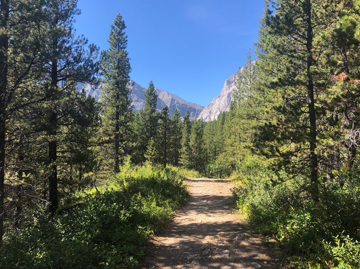
From there you will continue walking until you enter the forest.
There are not too many views while walking in the forest and that’s the reason why some people might find this trail boring.
To avoid this boring section as I mentioned you can bike and then hide your bike in the bushes.
When I did my hike it was a prime berry season and there are a lot of berry bushes on this trail so expect to see a bear.
I didn’t see any bears but bear scat was everywhere so hike in groups if you can, make noise, and bring your bear spray.
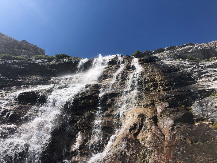
At around 8.5 km from the start of the hike, you will exit the forest and should see a waterfall in the distance.
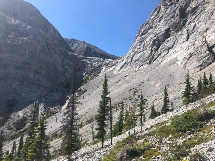
Carnarvon Lake is located on top of the mountain over the waterfall.
Follow the path to the waterfall.
This trail is pretty exposed and you might need to do some scrambling.
You should see the chains right off the waterfall.
There are several chain sections that you will use.
Pay special attention to the other hikes to avoid getting hit by rocks falling from the top.
After you climb to the top, you will reach the beautiful Carnarvon Lake.
When I was there, it was extremely windy at the top but fortunately, if you follow the lake to the tree area on the other side there is no much wind there.
The area around the trees has the best views and the water is blue and crystal clear.
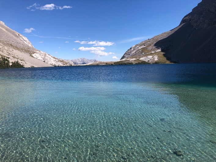
I couldn’t resist and went for a quick deep in the lake.
As you would expect the water is cold but swimming in this clear glacier water is so worth it.
To get even better aerial views of the lake, hike the hill above the lake.
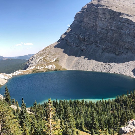
From there you can see Carnarvon Lake from the top as well as BC mountains in the distance.
Camping and fishing at Carnarvon Lake
I barely saw any people when hiking to Carnarvon Lake in the morning so I was pretty surprised to see about 5 groups with camping gear on my way back from the lake.
There are several spots on the lake where you can hide from the wind and put up a tent.
The views are absolutely gorgeous there and I am definitely planning to come back to do some camping next year.
The lake is located in a wildland park zone so random camping is allowed.
Just be careful when making fires and pick up all the garbage because it would be a shame to trash such a gorgeous pristine lake.
Fishing is allowed in this lake and I saw several rainbows swimming around when I went for a dip.
It might be worth confirming the fishing regulations before going there just to make sure that nothing changed.
Did you know that your internet service provider can track your online activity? Want to hide your identity online and keep your browsing habits private? Try NordVPN!
*This post might contain affiliate links. If you click on a link, I might receive a small commission.